
Newsletter no. 3
NATURE-Based Solutions for Demonstrating Climate-Resilient Critical Infrastructure
Cartography and Topology for Detecting Risks
The NATURE-DEMO project focuses on the design, development and dissemination of Nature-Based Solutions through the preparation of several European demonstrators. These will contribute to the development of solutions which mitigate the catastrophic effects that erode natural environments due to different causes, such as risks derived from landslides, floods, forest fires and droughts, among many others.
Therefore, the scope of NATURE-DEMO encompasses actions in settlements, green infrastructure, roads and railroads, as the main areas affected by these risks. A lot of different geographic scenarios must be assessed accordingly. For this commit, maps are one of most important tools.
Today's Mapping
Early maps were created by the Babylonians on clay tablets around 2300 B.C., depicting regions and routes. The Greeks made significant contributions, with Anaximander creating one of the earliest known maps of the world in the 6th century B.C. Ptolemy's work in the 2nd century A.D. laid the foundation for modern cartography with his book "Geographia" which included detailed maps and a coordinate system.
The great advancements were born during the Age of Exploration in the 15th and 16th centuries. European explorers like Christopher Columbus and Vasco da Gama relied on increasingly accurate maps for navigation. This period saw the development of more sophisticated techniques, such as the use of latitude and longitude, and the creation of the Mercator projection by Gerardus Mercator in 1569.
The great advancements were born during the Age of Exploration in the 15th and 16th cen‐ turies. European explorers like Christopher Columbus and Vasco da Gama relied on in‐ creasingly accurate maps for navigation. This period saw the development of more sophisticated techniques, such as the use of latitude and longitude, and the creation of the Mercator projection by Gerardus Mercator in 1569.


Think about the impact of technological advancements in the 20th and 21st centuries. The advent of aerial photography, satellite imagery, and Geographic Information Systems (GIS) revolutionized cartography. These technologies enabled the creation of highly detailed and dynamic maps, facilitating real-time data integration and analysis. Modern cartography now plays a crucial role in urban planning, environmental monitoring, and disaster management. In NATURE-DEMO we will rely on this type of technology, since it creates a common database on which to work not only for the different collaborating countries, but in real time through tools that can be posted online.
Also, the modern knowledge of topology, a branch of mathematics, that focuses on the properties of space that are preserved under continuous transformations, has been used in the new informatic tools applied to mapping. It deals with concepts like continuity, compactness, and connectedness, which are crucial for understanding spatial relationships and make it possible using dynamic data.
Think about how climate change has increased the need for accurate and up-to-date maps. Changes in weather patterns, such as rising sea levels, floods, and droughts, require constant monitoring and proper planning. Modern maps not only show topography and infrastructure but also include data on climate risks and vulnerabilities. This information is vital for developing mitigation and adaptation strategies to protect communities and ecosystems.
NATURE-DEMO aims to obtain through these tools the necessary analysis to apply it to real-world infrastructures, with different functions and in different places, but all under the risks of a common cause: climate change.
Tools and Representation
GIS, drones, and satellite imagery are some of the most used technologies. GIS allows for the integration and analysis of spatial and non-spatial data, facilitating the creation of thematic maps and the identification of patterns and trends. Drones and satellite imagery provide high-resolution data essential for environmental monitoring and disaster management and new local changes to data.
Also the representation of geospatial data has improved with the use of three-dimensional models and simulations. These representations allow for a better understanding of topography and infrastructure, as well as associated risks. For example, 3D models can simulate floods and landslides, helping authorities plan and respond more effectively. This representation is intuitive and illustrative, so all NATURE-DEMO collaborators can feel comfortable when sharing and visualizing the different challenges.

Additionally, online mapping platforms enable users to access and share geospatial information in real-time, enhancing collaboration and decision-making.
Infrastructure spatial-information models
Geospatial mapping of critical infrastructure, encompassing civil/technical, and green elements, is crucial for planning, construction, maintenance, and management. It provides a comprehensive digital representation of existing conditions and proposed developments, enabling informed decision-making. Civil/technical infrastructure includes transportation networks (roads, railways), utilities (pipelines, power lines), and built structures (bridges, dams). Green infrastructure encompasses natural and semi-natural areas like forests, wetlands, and parks, crucial for ecosystem services.
Mapping precision depends on the technology used and the project requirements. LiDAR (Light Detection and Ranging) can achieve centimeter-level accuracy for terrain and structure mapping. UAV-based photogrammetry can provide similar precision depending on flight parameters and ground control points. Satellite imagery typically offers lower spatial resolution, but advancements in sensor technology are constantly improving this. The integration of GIS (Geographic Information Systems) and BIM (Building Information Modeling) is transforming infrastructure mapping.
BIM provides detailed 3D models of individual assets, while GIS provides the spatial context at a larger scale.
Integrating these allows for clash detection (identifying potential conflicts between different infrastructure elements), visualization of projects within their environment, and lifecycle management of assets by localising and identifying structural weaknesses and other vulnerabilities.
Latest developments in the field include the use of AI and machine learning to automate feature extraction from geospatial data (e.g., identifying trees in LiDAR data for green infrastructure mapping). Cloud computing enables efficient storage and processing of massive datasets. Digital twins, virtual representations of physical infrastructure and its performance (e.g. FEM/CFD), are being created by combining geospatial data, BIM models, and real-time sensor data, allowing for predictive maintenance and optimized operation. These advancements are leading to more accurate, efficient, and integrated geospatial mapping of infrastructures, supporting sustainable and efficient management.
These developments bring together many different technologies and fields of knowledge. NATURE-DEMO involves many partners from different backgrounds, from universities of various scientific backgrounds to technology centres, where different points of view in fields of knowledge as well as cultures are sought together to obtain holistic conclusions that can help at a global level.
How to Detect Risks
Risk management relies on the integration of geospatial data, mathematical models, and cutting-edge technologies within cartographic and topological analyses. Risk maps combine geospatial data with information on specific threats, such as floods and landslides due to climate changes. These maps are essential tools for emergency planning and management, allowing authorities to identify high-risk areas and develop mitigation strategies. The integration of cartographic and topological disciplines supports the development of dynamic risk assessment tools, which are, also, crucial for effective disaster management, infrastructure resilience, and climate adaptation strategies.
Changes in precipitation patterns, rising temperatures, and melting glaciers are just some of the effects of climate change that can be monitored through cartography and topology. Integrating climate data into risk maps allows for a more accurate assessment of threats and the implementation of more effective preventive measures.
Advancements in cartography and topology have significantly improved risk detection and analysis. Modern mapping techniques, including satellite imagery and remote sensing, enable continuous monitoring of environmental hazards and early warning for potential disasters.
By integrating geospatial data, historical records, and predictive models, hazard maps provide valuable insights into the likelihood and severity of potential climate threats. Advances in Geographic Information Systems (GIS), remote sensing, and real-time data analytics have enhanced the precision and adaptability of hazard maps, ensuring more effective disaster preparedness and response.
Using cartography and topology, vulnerability assessments identify high-risk areas by analyzing population density, infrastructure conditions, access to resources, and environmental exposure, besides any other society event that can be detected as impacted.
Integrating real-time climate data with risk maps enhances disaster preparedness by allowing authorities to anticipate extreme weather events and develop proactive mitigation strategies. These strategies are being analyzed in the NATURE-DEMO catalogue in order to have a wide range of tools adapted to all types of environments and detected risks that can be applied depending not only on technical limitations, but also taking into account the interests of the stakeholders involved.
Risk maps serve as essential tools for emergency planning, integrating hazard data with geographic information to pinpoint high-risk zones. For instance, flood risk maps combine historical precipitation patterns, topography, and urban infrastructure data to highlight areas susceptible to severe flooding.

Similarly, earthquake-prone regions can be assessed using topological models that analyze fault lines, soil composition, and building density. These maps enable decision-makers to develop targeted mitigation strate‐ gies, such as improved zoning regulations, early warning systems, and infrastructure reinforcements.
Beyond immediate disaster risks, cartography and topology also help track long-term environmental changes. Shifts in precipitation, rising temperatures, and glacier retreat are all indicators of climate change that can be visualized and analyzed through advanced mapping techniques. By incorporating climate models into geospa‐ tial risk assessments, authorities can anticipate future threats and implement proactive adaptation measures. For example, coastal erosion maps can inform policies on sustainable land use, while wildfire risk models help predict and prevent large-scale forest fires.

The integration of satellite imagery, remote sensing, and artificial intelligence with infrastructure information further refines risk mapping capabilities. High-resolution spatial data combined with real-time analytics allows for continuous monitoring of hazard-prone areas. Machine learning models can detect changes in terrain, water levels, or vegetation health, providing early warnings for potential disasters.
As we advance our ability to map and analyze risks, the fusion of cartography, topology, and climate science remains critical for building resilience against environmental hazards. By leveraging these tools, projects like NATURE-DEMO contribute to safer, more sustainable landscapes, ensuring that communities are better prepared for the challenges of a changing world.
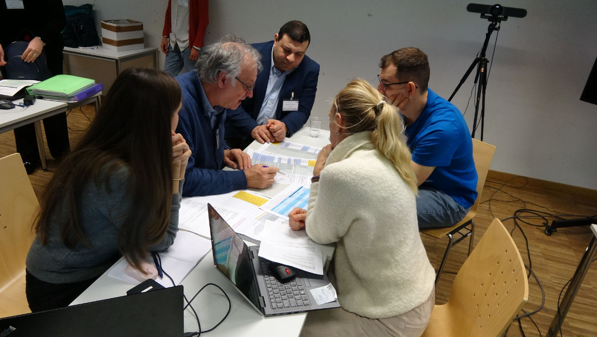
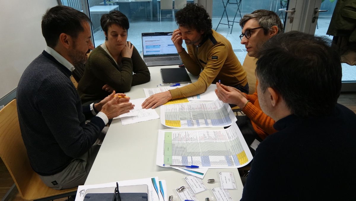
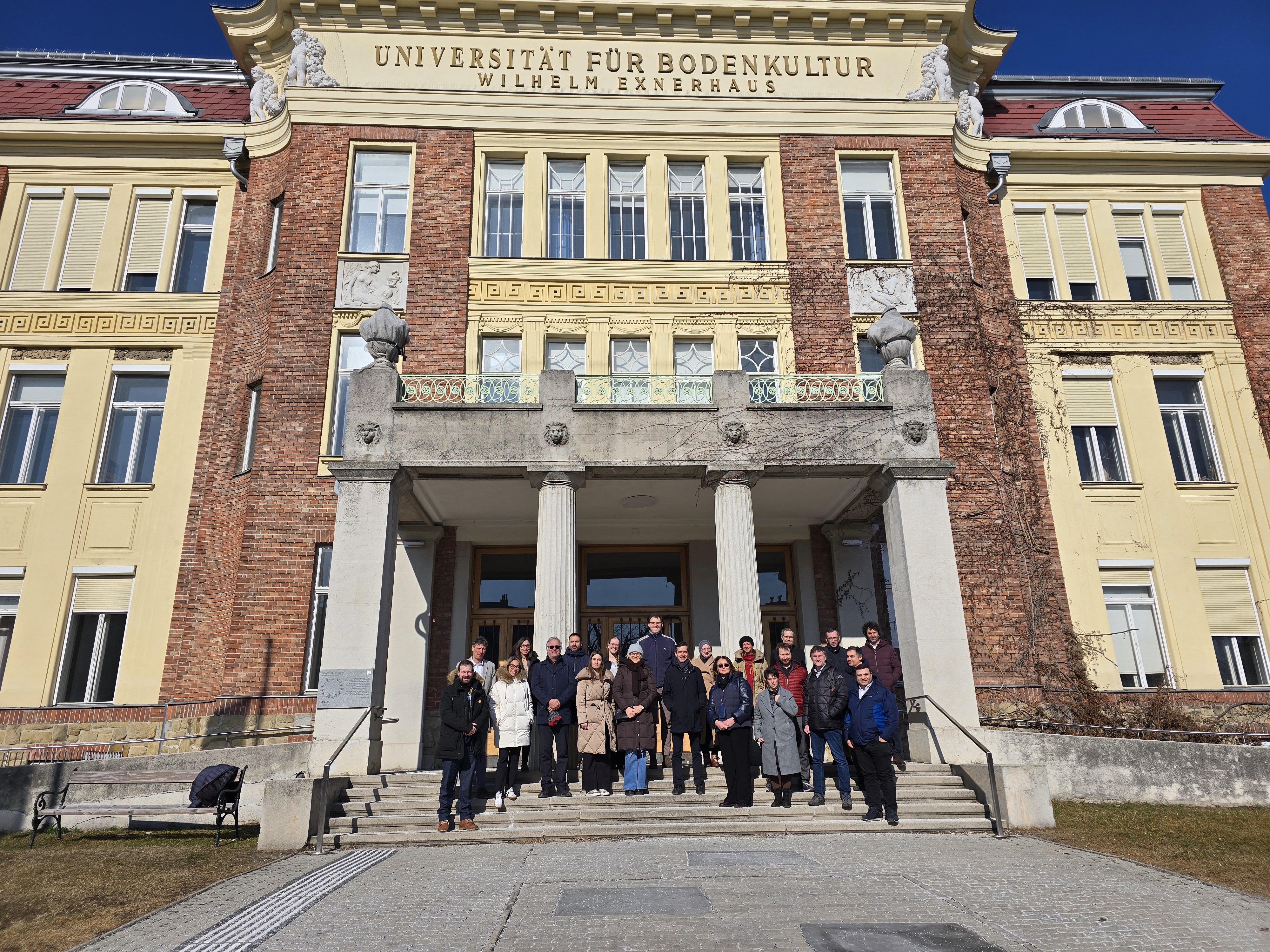
Vienna Workshop | 18-20 February 2025
The Vienna Workshop, organized by Alchemia Nova Research & Innovation (ANRI) and the University of Natural Resources and Life Sciences (BOKU), Vienna, brought together project partners to collaborate on key aspects of the NATURE-DEMO initiative. The agenda featured interactive workshops, case study presentations, and discussions on risk assessment methodologies, Nature-based Solutions (NbS), and data-driven evaluation methods.
Key Highlights:
- Partners engaged in group discussions and hands-on exercises to refine NbS selection and assess measurable benefits.
- Presentations from various demo sites provided insights into real-world NbS applications.
- Experts from BOKU University and The Environmental Hydraulics Institute of Cantabria (FIHAC) led a session on structured methodoologies for evaluating environmental risks.
- Discussions focused on project progress, future collaborations, and publication plans.
During the workshop, short video interviews were recorded with DigInnoCent s.r.o., Liberec, Czech Republic, represented by coordinator Mohamed Eldessouki, alongside demonstrators from:
- Demo 1a - Lattenbach, Austria
- Demo 1b - Gschliefgraben, Austria
- Demo 2 - Brașov, Romania
- Demo 3 - Ljubljana, Slovenia
- Demo 4 - Zvolen, Slovakia
- Demo 5 - Struga, North Macedonia
These interviews will contribute to communicate the importance of NbS on a broader scale.
The Vienna Meeting successfully strengthened collaboration, set clear directions for the next project phases, and reinforced our commitment to sustainable solutions!

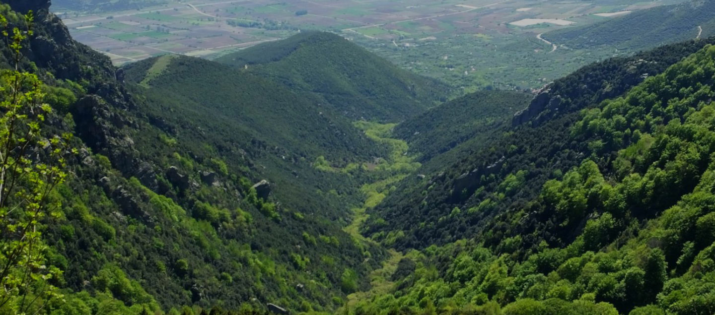
Demo 1: Lattenbach Valley, Austria
The Nature-Demo project identified one of the infrastructures in Lattenbach Valley, Austria, as requiring significant improvements and upgrades. The Lattenbach Valley, a vital part of the Austrian Alps and home to 5,000 residents and critical infrastructure faces significant threats from climate change-induced erosion and landslides. According to recent climate models in the region, extreme rainfall events are expected to increase, destabilise slopes, and generate dangerous debris flows, placing the habitat and infrastructures directly in the path of destruction.
The NATURE-DEMO project, a collaborative effort between BOKU University, the Torrent and Avalanche Control Authority, The Railway Authority, and contracted construction companies, aims to protect the Lattenbach Valley by constructing a real-world demonstrator that stands out for its innovative approach and comprehensive solutions.
The NATURE-DEMO project, a collaborative effort between BOKU University, the Torrent and Avalanche Control Authority, The Railway Authority, and con‐ tracted construction companies, aims to protect the Lattenbach Valley by constructing a real-world demonstrator that stands out for its innovative ap‐ proach and comprehensive solutions.
Monitoring networks will measure NbS effectiveness using advanced analytics and machine learning, integrating data from climate stations, soil moisture sensors, remote sensing, surveying techniques, HD cameras, and on-site damage surveys. This integrated monitoring will allow the Lattenbach Valley to serve as a living laboratory, providing valuable insights into NbS performance, optimizing interventions, and enhancing climate resilience. The project will also contribute to a Digital Teaching Lab, training students in environmentally friendly infrastructure design and generating models applicable to other regions' replicators facing similar climate threats.

Overview and locations of the different monitoring systems of the demonstrator from Lattenbach Valley in Tyrol, Austria
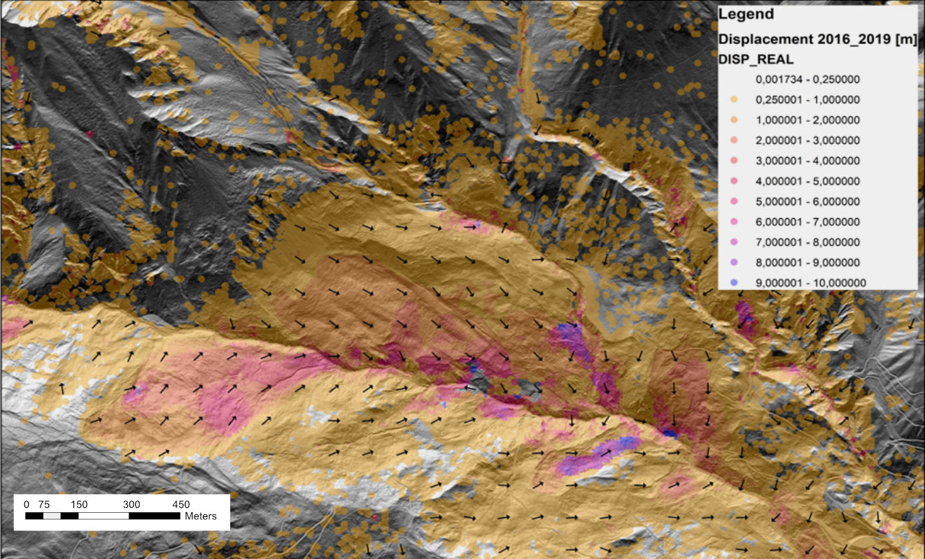
Image courtesy, Dipl. -Ing. Erik Kuschel, Institute of Applied Geology (IAG), BOKU
NATURE-DEMO Partners


Stay tuned!